Information
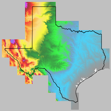 Texas statewide terrain data is divided into multiple 1-degree tiles.
This service converted each tile into a
Cloud Optimized GeoTIFF (COG) and then combined them into a
virtual raster (VRT) for seamless access.
Additionally, links to tiles are provided below.
Texas statewide terrain data is divided into multiple 1-degree tiles.
This service converted each tile into a
Cloud Optimized GeoTIFF (COG) and then combined them into a
virtual raster (VRT) for seamless access.
Additionally, links to tiles are provided below.
For questions, contact:
Links and Resources
| Resource | Action |
|---|---|
| Statewide VRT (for GIS software) | Download VRT |
| Tile Index (GeoJSON) | Download Index |
Data Prepared by
Data Served by