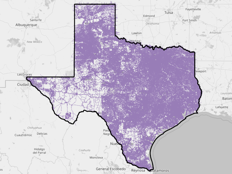
Information
 Public road lines (split at intersections) extracted from OpenStreetMap on 2025.03.17 from OSM GeoFabrik
Raw data are loacated here. We only consider roads with fclass of certain types. An ogr2ogr command with an
SQL selection query is applied as below:
Public road lines (split at intersections) extracted from OpenStreetMap on 2025.03.17 from OSM GeoFabrik
Raw data are loacated here. We only consider roads with fclass of certain types. An ogr2ogr command with an
SQL selection query is applied as below:
ogr2ogr -dialect sqlite -sql "select * from gis_osm_roads_free_1 where fclass in ('motorway', 'motorway_li
nk', 'tertiary', 'primary_link', 'secondary', 'residential', 'unclassified', 'primary', 'trunk', 'tertiary_link', 'trunk_link', 'secondary_link')"
-t_srs epsg:3081 osm_texas_roadlines_20250317_epsg3081.gpkg gis_osm_roads_free_1.shp -nln roadlines
For questions, contact:
Links and Resources
| Resource | Action |
|---|---|
| Texas' OSM Public road lines split at intersections (FlatGeoBuf) | Download File |
Data Prepared by
Data Served by
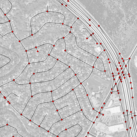
Sample Layer Image