Information
 The Road Elevation Model (REM) Digital Surface Model (DSM) provides elevation data for public roadways across Texas.
Derived from the statewide TxGIO lidar collections, the DSM captures surface elevations along the driven path, including bridge crossings and culverts.
Limits are is derived from buffered OpenStreetMap road linework.
Each TxDOT District's REM is provided as Cloud Optimized GeoTIFFs (COG) and then combined them into a statewide virtual raster (VRT) for seamless access.
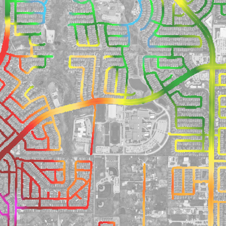
The Road Elevation Model (REM) Digital Surface Model (DSM) provides elevation data for public roadways across Texas.
Derived from the statewide TxGIO lidar collections, the DSM captures surface elevations along the driven path, including bridge crossings and culverts.
Limits are is derived from buffered OpenStreetMap road linework.
Each TxDOT District's REM is provided as Cloud Optimized GeoTIFFs (COG) and then combined them into a statewide virtual raster (VRT) for seamless access.
Additional detial regarding the creation of these data are availble here.
For questions, contact:
Links and Resources
| Resource | Action |
|---|---|
| Road Elevation VRT (for GIS software) | Download VRT |
| District Road Elevation Index (GeoJSON) | Download Index |
Data Prepared by
Data Served by