Information
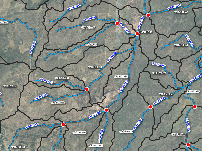
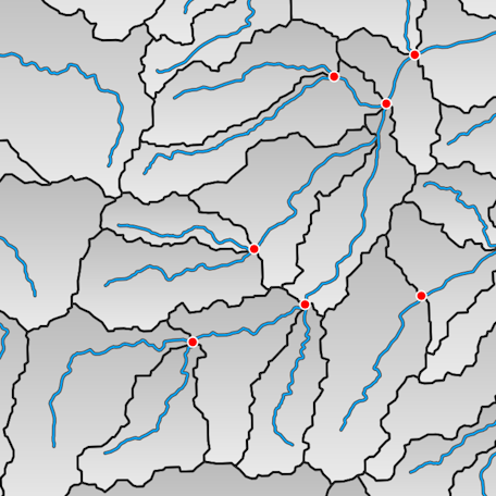 NextGen Hydrofabric is a geospatial dataset (geopackage) that provides watershed boundaries, stream centerlines, and associated attributes.
It also encodes the network topology of these features, enabling analysis and modeling of how water moves through interconnected hydrologic systems.
This resource provides hydrologic data for HUC-2 Region 12, covering a larger portion of the state of Texas. These data are Reference Network v2.0
Additional detial regarding these data are availble here.
NextGen Hydrofabric is a geospatial dataset (geopackage) that provides watershed boundaries, stream centerlines, and associated attributes.
It also encodes the network topology of these features, enabling analysis and modeling of how water moves through interconnected hydrologic systems.
This resource provides hydrologic data for HUC-2 Region 12, covering a larger portion of the state of Texas. These data are Reference Network v2.0
Additional detial regarding these data are availble here.
For questions, contact:
Links and Resources
| Resource | Action |
|---|---|
| Catchments (FlatGeoBuf) | Download File |
| Flowpaths (FlatGeoBuf) | Download File |
| Nextgen Hydrofabric (gkpg) | Download File |
Data Prepared by
Data Served by
Sample Layer Image