Information
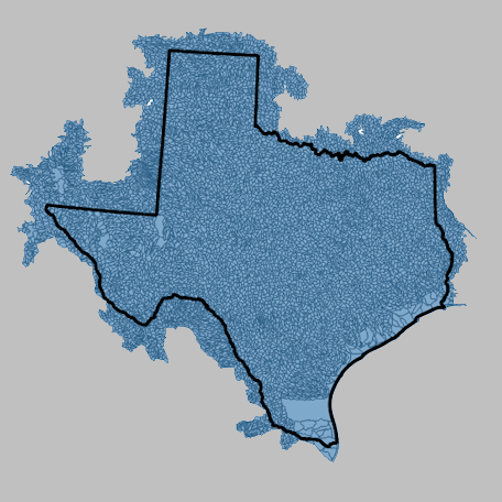 This file is a Texas HUC-12 subwatershed boundary layer, sourced from the
USGS National Hydrography Dataset (NHD) — Hydrologic Unit 12 Subwatershed (Layer ID: 5).
It has been reprojected to EPSG:5070 (NAD83 / Conus Albers, equal-area) and converted to
FlatGeobuf (.fgb) format for streaming access.
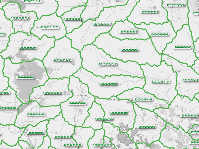
HUC-12 units are watershed delineations in the U.S., each representing a
drainage area of roughly 40–250 km².
This file is a Texas HUC-12 subwatershed boundary layer, sourced from the
USGS National Hydrography Dataset (NHD) — Hydrologic Unit 12 Subwatershed (Layer ID: 5).
It has been reprojected to EPSG:5070 (NAD83 / Conus Albers, equal-area) and converted to
FlatGeobuf (.fgb) format for streaming access.
HUC-12 units are watershed delineations in the U.S., each representing a
drainage area of roughly 40–250 km².
Learn more about the
Watershed Boundary Dataset (WBD).
Explore HUC boundaries interactively via the
USGS WBD Map Service.
For questions, contact:
Links and Resources
| Resource | Action |
|---|---|
| HUC-12 Polyons in Texas (FGB) | Download File |
Data Prepared by
Data Served by
Sample Layer Image